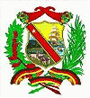
Map - Miranda (state) (Miranda)

Miranda  (Miranda)
Miranda State (Estado Miranda, ) is one of the 23 states of Venezuela and the second most populous after Zulia State. As of the 2011 census, it had a population of 2,675,165 residents. It also has the greatest Human Development Index in Venezuela, according to the Venezuelan National Institute of Statistics (Instituto Nacional de Estadistica, Caracas). The most recent population estimate was 3,194,390 in mid-2016. Miranda is an important center for political, economic, cultural and commercial activities. The state is administered by a governor, and is sub-divided into 21 municipalities, each under a mayor.

Miranda State covers a total surface area of 7,950 km2.

 
Map - Miranda  (Miranda)
Map
Google Earth - Map - Miranda (state)
Google Earth
Openstreetmap - Map - Miranda (state)
Openstreetmap
Map - Miranda  - Esri.WorldImagery
Esri.WorldImagery
Map - Miranda  - Esri.WorldStreetMap
Esri.WorldStreetMap
Map - Miranda  - OpenStreetMap.Mapnik
OpenStreetMap.Mapnik
Map - Miranda  - OpenStreetMap.HOT
OpenStreetMap.HOT
Map - Miranda  - CartoDB.Positron
CartoDB.Positron
Map - Miranda  - CartoDB.Voyager
CartoDB.Voyager
Map - Miranda  - OpenMapSurfer.Roads
OpenMapSurfer.Roads
Map - Miranda  - Esri.WorldTopoMap
Esri.WorldTopoMap
Map - Miranda  - Stamen.TonerLite
Stamen.TonerLite
Country - Venezuela
Currency / Language  
ISO Currency Symbol Significant figures
VES Venezuelan bolívar BsS. or Bs. 2
ISO Language
ES Spanish language
Neighbourhood - Country  
  •  Brazil 
  •  Colombia 
  •  Guyana